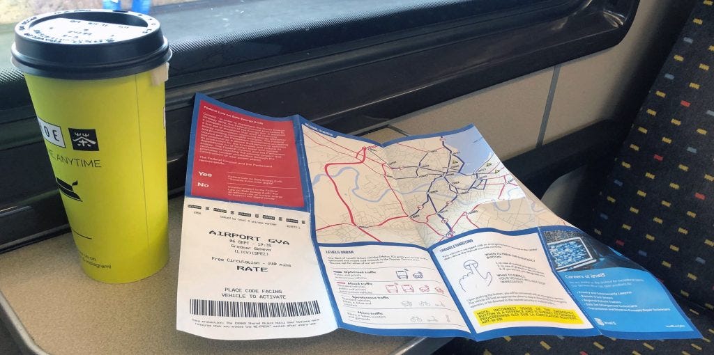
The Geneva 2050 Mobility Map is a design fiction by Girardin & Nova. It takes the form of a foldable transportation map brought back from a near-future Geneva, exploring how the city might change in a world where autonomous vehicles have become mainstream.
When imagining the future of mobility, people tend to view coming times through their own particular lenses. Much of the discussion around self-driving cars focuses on the ideal scenario of traffic optimisation, skipping over the complications. Yet any decision-maker serious about evaluating automation must be able to look at the details from multiple perspectives.
“Put traffic engineers in charge of the street and you get traffic. If we put gardeners in charge of the street, we'd get gardens.” — Dan Hill, designer and urbanist
This is what design fiction is good at: uncovering the implications of today's decisions. Rather than a PowerPoint deck or a corporate white paper, the mundane form of a free city map puts a possible future into the hands of a large audience. Like Geneva, every city has to deal with complex issues when anticipating the evolution of mobility — traffic, modes of transportation, energy sources. This is why the Department of Mobility at the Canton of Geneva commissioned us to investigate their “what if” scenarios around automated driving.
The Map
We wanted a popular artifact, intelligible by a large audience. With the help of designer Jacob Israel Viadest Lara, we created a foldable map of Geneva and brought it back from the future to be handed out to locals and tourists alike. The street plan introduces roads that accommodate different modes of mobility — pedestrian zones, optimised and mixed traffic, and the continued coexistence of non-autonomous vehicles.
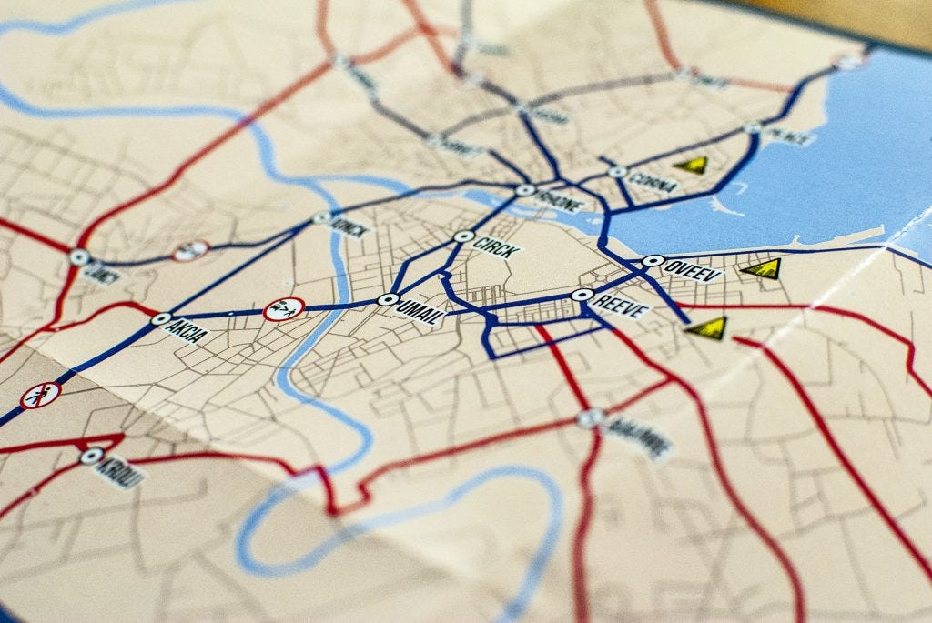
The transportation network of a near-future Greater Geneva, with optimised (blue) and mixed (red) traffic.
A new legend describes a world that does not yet exist: pick-up and drop-off points, levels of automated traffic, road segments forbidden to vehicles on autonomy level 4 or more, and the “urban canyons” — narrow streets where autonomous vehicles struggle with connectivity.
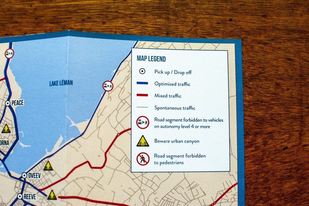
The map legend, including the warning to “beware urban canyon”.
The Stories
The foldable format leaves room for stories alongside the street plan. Here are some of the things you might discover looking at the map:
The global AI company Level 5 has joined Unireso, the umbrella organisation that coordinates Geneva's public transport, providing pick-up and drop-off stations for a fleet of on-demand autonomous vehicles. In the arrival hall of Geneva Airport, visitors receive a free circulation pass courtesy of Level 5 — 240 minutes of access to the optimised and mixed road network across Greater Geneva.
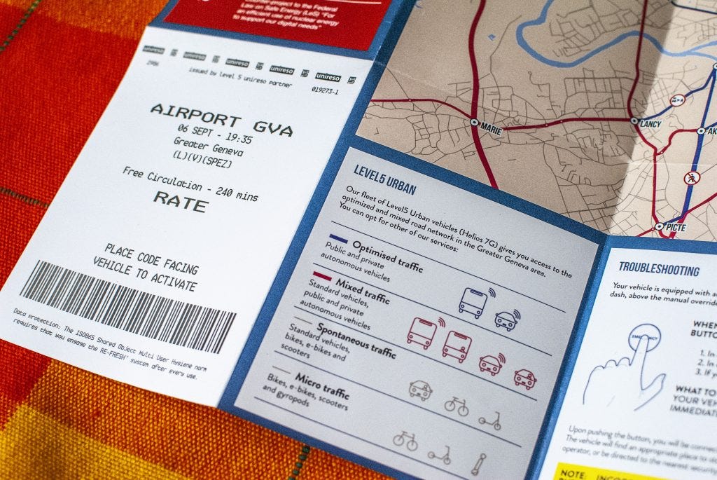
A free 240-minute circulation pass issued by Level 5 and Unireso at Geneva Airport.
The adoption of autonomous vehicles reshapes energy production in Switzerland. Political parties and the public clash: some advocate solar-powered solutions to reduce reliance on foreign fossil fuels, while others argue for efficient nuclear energy to support the new digital demand, potentially meaning investment in new power plants. And the presence of Level 5 gives rise to unexpected new jobs — Remote Truck Drivers, Regional Vehicle Trainers, and Privacy and Cybersecurity Lawyers.
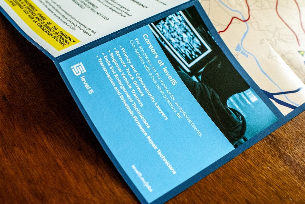
“Careers at Level 5”: the new roles of an autonomous-vehicle economy.
The Process
Technically, we imported OpenStreetMap layers into a Geographic Information System (QGIS) to organise and project the road-segment data into a possible future. We iterated several times, discussing the results, and Jacob Israel Viadest Lara used Illustrator to polish the details — removing road segments, highlighting potential consequences, and imagining new legends such as urban canyons and levels of automated traffic.
The intention of the Department of Mobility was to generate debate about the challenges that would be faced, the failures that might occur, the services that might emerge, and the new kinds of signage and rules that would be needed. The map was used at a local event about the future of the city, alongside a series of talks and workshops on the topics public institutions must deal with — places for children, agricultural facilities, urbanism against climate change. There, it acted as a tangible future around which a group of people with conflicting opinions could exchange points of view. The discussion revolved around two main themes: how urban traffic might be reconfigured and redefine what is acceptable on certain streets, and the energy infrastructure this technology would require.
In this project, we imagined the near future as a territory. Maps are a popular support for telling how humans, technology and nature co-evolve; they let an audience travel to a future without actually going there.